Wadi Namar Masterplan

Supporting UN Sustainable Development Goals


Project context
Momentum supported Gillespies in the preparation of its Wadi Namar competition entry in Riyadh, creating a pre-concept masterplan for the park.

Our work
Momentum is involved in producing a mobility vision for the masterplan, which involves setting out the overall transport strategies, including metro, BRT, pedestrian, vehicle, service, logistics, emergency services and parking.
Momentum is also assessing the mobility of all users and transport modes within and around the park, making sure appropriate connections around the Wadi and site are put into place.

Client outcomes
Calculations to determine the capacity of the park and car parking requirements have been undertaken to determine the best use of space on site. Our engineering team supported the design team led by Gillespies in an initial trip generation, calculating (based on Saudi Arabia planning and highway design manuals) the expected demand and capacity of the road network, and defining the number of lanes, typical sections, and key junction concept layouts for further study as part of the design development.


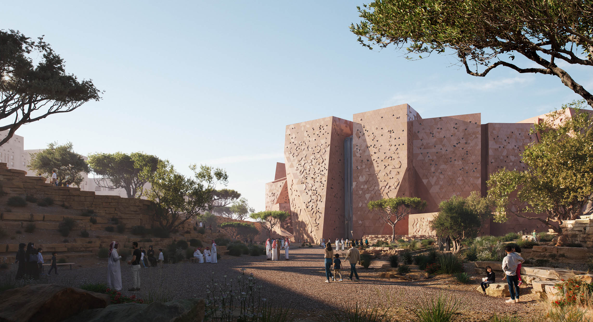

Wadi Hanifa

Supporting UN Sustainable Development Goals


Project context
The new Wadi Hanifa Sports Boulevard is a landmark 135km scheme featuring high-quality, attractive and fully-segregated routes for pedestrians, cyclists and equestrians, connecting Wadi Hanifah in the west to Wadi Al Sulay in the East. It’s seen as an important contributor to the Saudi Vision 2030 – to make Riyadh one of the most liveable cities in the world.
Our work
Momentum led on highways detailed design and as-built proposals on the Sports Boulevard, with aspects including surfacing, footways, signage and markings. We adhered to Saudi and Diriyah-specific design standards, and worked efficiently and responsively to demanding circumstances with the contractor already on site constructing sections of the scheme.
Client outcomes
Through precise design development and as-built validation, we achieved the project aims in providing end-to-end mobility and high-quality outputs on this innovative project. We helped to demonstrate how movement-led public realm can both connect different places and also become a destination in its own right in providing spaces where people will gather – to picnic, play and reconnect with nature and each other.


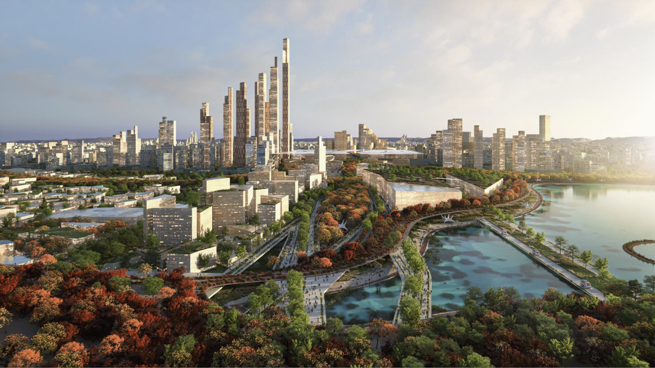
Project North Pole
Supporting UN Sustainable Development Goals
Project context
Developed in four distinct phases, Momentum provided engineering, modeling, planning, and GIS/Cartographic support to help devise a comprehensive transport solution for this new urban development.
Our work
A primary objective of the scheme was to establish a new paradigm for movement and travel in KSA by shifting away from its current heavy reliance on cars. To achieve this, the team introduced a groundbreaking multi-timed city approach. This innovative strategy proposed a package of sustainable transport options that embodied the transport vision adopted for North Pole. The aim was to strike a harmonious balance between the significance and function of various types of journeys, spanning from one minute to one hour.
Client outcomes
Throughout the project, a suite of transport solutions was meticulously presented across five presentation sessions and two full submissions. These encompassed crucial aspects such as trip generation, parking, delivery and servicing, road
hierarchy, rail stations and stops, engineering of junctions, interchanges, and sections, as well as bus strategies and micromobility and active transport. The collective effort of the transport team resulted in a comprehensive and forward-thinking transport strategy that aligned seamlessly with the overall vision for Project North Pole, aiming to pave the way for a more sustainable and efficient urban landscape.
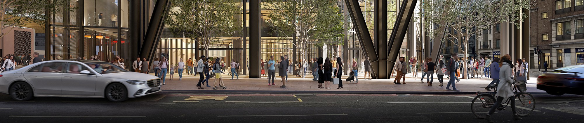
Olympia

Supporting UN Sustainable Development Goals
Project context
Olympia is an exhibition centre, event space and conference centre in West Kensington, London. The venue is home to a range of international trade and consumer exhibitions, conferences and events. Olympia has been a mainstay in the world exhibition trade for over 130 years and currently attracts over 1.6m visitors a year across 220 event days. The Olympia Estate was successfully acquired by Yoo Capital and German institutional investors in 2017, with the intention to comprehensively redevelop the Estate to provide a broad mix of creative and commercial land uses.
Our work
Momentum has been working since July 2017 on the long-term vision and masterplan for the 14 acres Olympia Estate. The masterplan proposes to remove the existing event-related traffic from the adjacent highway network and provide 2.5 acres of attractive public realm to serve the wider range of uses to be introduced on site and complement and enhance the current exhibition halls, including two hotels, one theatre, one music venue, one cinema, office space and co-working and retail.
Client outcomes
As part of the design team, we have developed access strategies for goods vehicles servicing the estate, as well as strategies for improving future visitors’ access to the site both during construction and once implemented. This has included data analytics on vehicles movements to define the space requirements for the logistics hub, identifying key pedestrian links, extensive traffic modelling, parking surveys, station modelling and pedestrian comfort level assessments. We have engaged with residents and officers from the London Borough of Hammersmith and Fulham and Transport for London as part of the pre-application process and post-planning engagement.


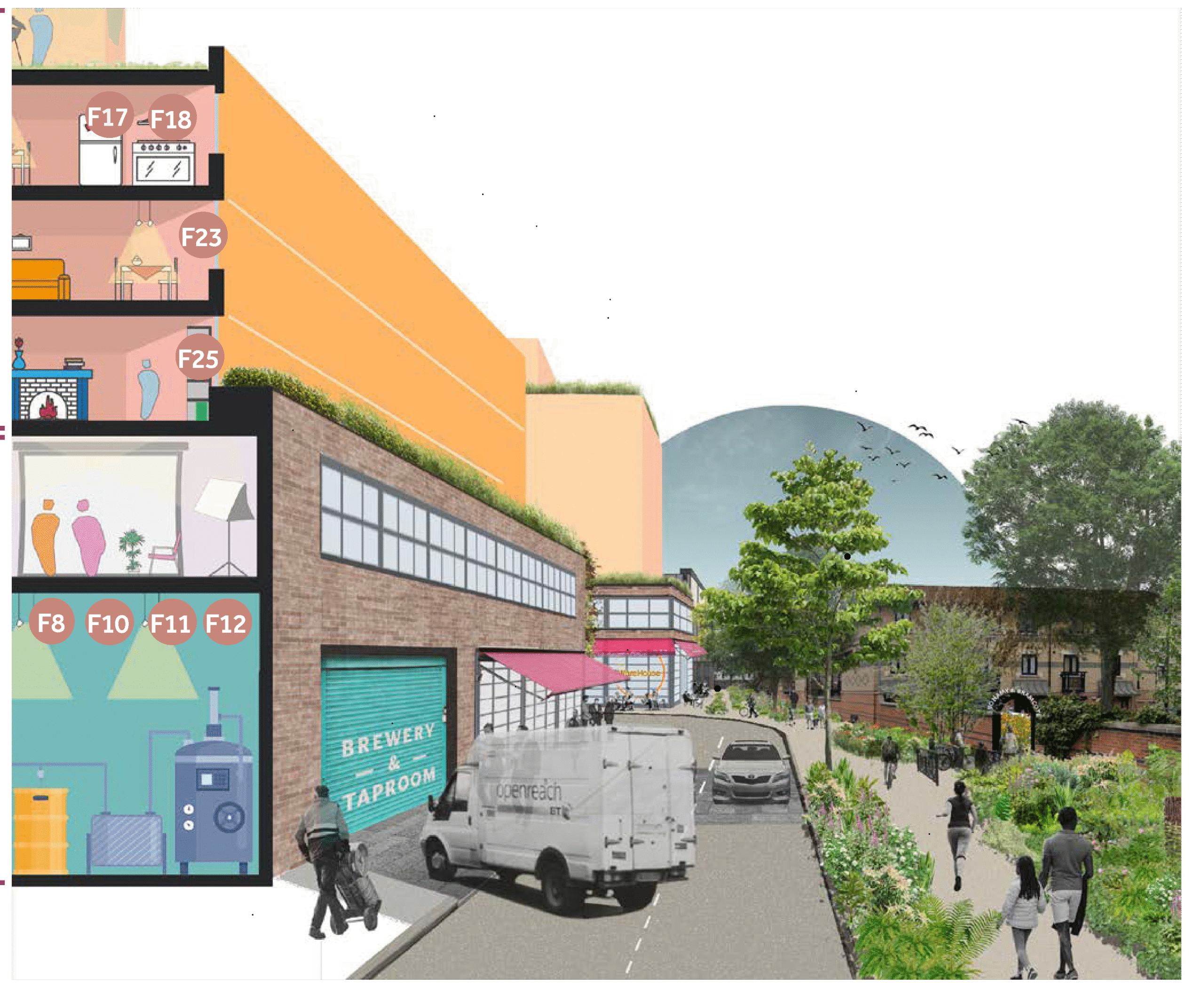
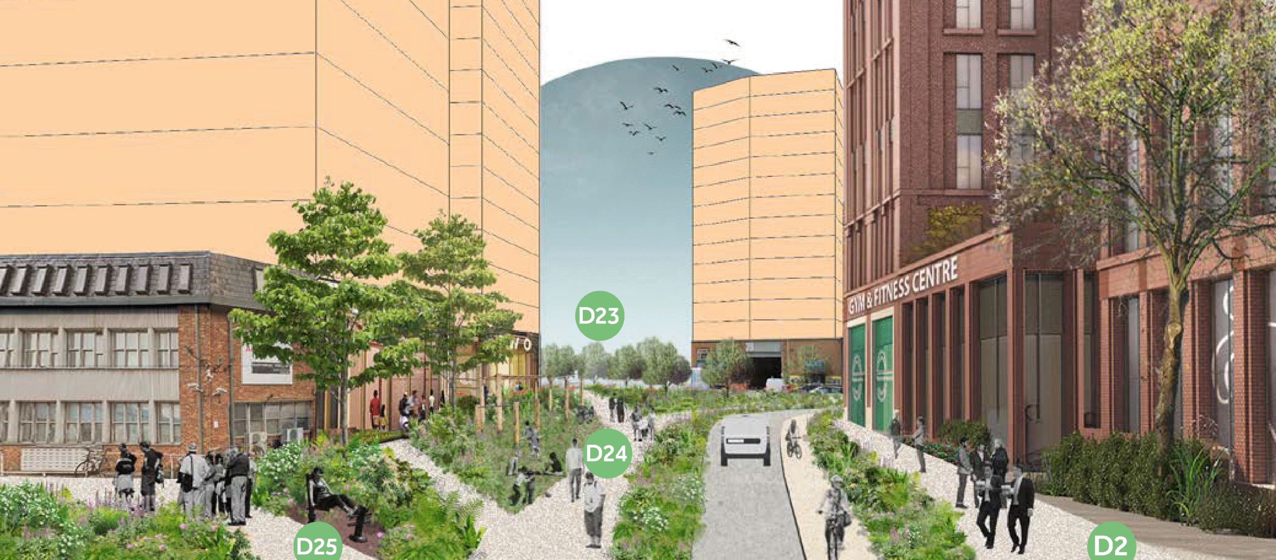
Old Kent Road masterplan
Supporting UN Sustainable Development Goals
We provided input into the transport aspects of masterplanning Design Codes for the area of Sandgate Street, Verney Road and Old Kent Road within the Old Kent Road masterplan for the London Borough of Southwark.
Design codes develop the masterplan in a greater level of detail, setting out the design principles to be followed by developers to gain planning consent.
This involved working with Farrells masterplanners to review the streets and places hierarchy for the area in terms of transport and movement, mapping servicing access and routes, providing multi-modal access maps for walking, cycling, public transport, logistics and vehicular access and advising on designs for typical street sections and walking and cycling routes through green spaces.
Our work helped to plan better connections for pedestrians and cyclists to a proposed linear park along the alignment of Verney Road and improve north-south connections between Verney Road and Old Kent Road. These proposed improvements will help to revitalise Old Kent Road as a high street and allow for intensification of the development, providing homes, workplaces, shops and leisure uses.

Markets & Projects
Masterplanning

“We consider all of the transport elements of masterplanning alongside, and integrated with, land use planning to ensure developments are both sustainable and meet the needs of the communities they serve.”
A masterplan is a framework that directs the development of a region, area, city, neighbourhood, precinct or building. With accessibility in urban and suburban areas becoming increasingly complex and constrained, it is fundamental for development to occur sustainably and to complement the existing environment. Consequently, it is essential that transport and connectivity are integrated into the first steps of developing a masterplan to ensure that the vision and viability of a scheme are realised.
Momentum provides transport masterplanning services to understand, analyse, plan and advise a masterplan in terms of its connectivity, logistics, and transport impact. We collaborate with a wide range of public and private clients to design masterplans that facilitate accessibility by sustainable forms of transport and establish effective delivery and servicing strategies. Our approach aims to utilise space for accessibility and connectivity within a masterplan efficiently, ensure transport strategies are sustainable and suitable for all land uses and transport users within a masterplan, and achieve integration with the broader community.